As wildfire season looms, bringing with it the perennial threat of sudden, sweeping evacuations, a critical question often arises: are the designated escape paths truly safe? Or, more precisely, are they even passable? A groundbreaking Kelowna-based technology firm is stepping up, deploying an advanced AI-powered system to revolutionize how evacuation routes are assessed and understood, transforming emergency preparedness across British Columbia.
The harrowing 2023 wildfire season proved a stark catalyst for local entrepreneur Ryan Gallagher. Witnessing residents flee their homes, often on rough, unpredictable backroads, illuminated a dangerous gap in emergency planning: knowing a route exists isn’t enough. What if that critical path to safety is riddled with treacherous potholes, loose rock, sudden washouts, or simply unsuitable for the family sedan burdened with children, pets, and precious supplies?
Enhancing Evacuation Routes with Cutting-Edge AI
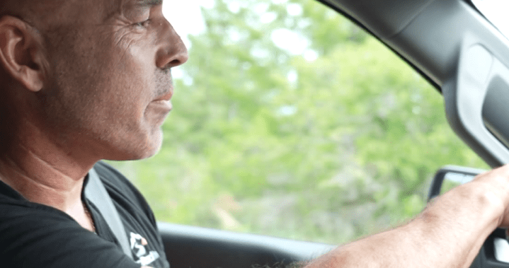
Gallagher’s answer arrived in the form of Back Road Intel. This innovative system employs sophisticated sensors and artificial intelligence to meticulously monitor secondary roads and potential evacuation routes. On a recent drive along the Central Okanagan’s Chute Lake Road, a known backroad connector, Gallagher vividly demonstrated the system’s necessity. Conditions, he noted, could degrade dramatically in a matter of days, making once-viable roads perilous.
The technology gathers a wealth of data on road surfaces, potential hazards, and overall degradation. This raw information is then rapidly processed and analyzed by AI, providing emergency officials with an unprecedented, real-time understanding of which routes are genuinely viable during a crisis. It’s not just about an ‘open’ road; it’s about a road that can safely accommodate various vehicle types, preventing disastrous blockages.
“Imagine a mom and her kids trying to navigate this,” Gallagher remarked, gesturing to a particularly rough section of road. “When it comes to evacuations, the last thing you want is a flat tire or a broken axle. If you can’t clear these bumps, you will probably have a problem, and that’s a huge problem because you can block everyone behind you.”
Back Road Intel is already collaborating with regional districts, municipalities, and First Nations communities throughout B.C., empowering them with better data to make smarter, swifter decisions. This proactive approach aims to ensure that when the next disaster inevitably strikes, people aren’t forced to drive blindly into the unknown. For comprehensive disaster readiness resources, further information is readily available.