
Powerful tornado rips through western Sicily
Introduction & Key Takeaways
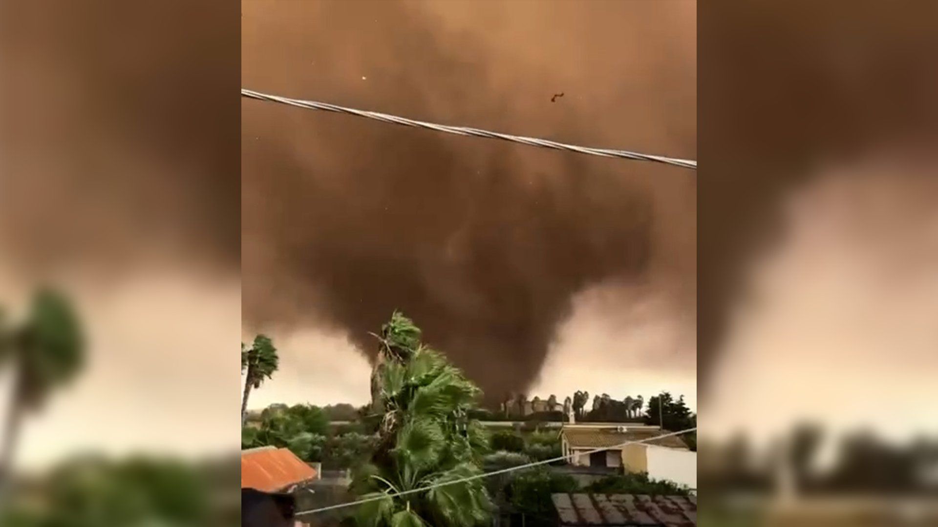
A violent and powerful Sicily tornado recently tore through the western regions of the island, leaving a trail of devastation across the cities of Marsala and Petrosino. This extreme weather event has resulted in multiple injuries, significant structural damage, and forced evacuations as local authorities scramble to secure the affected areas. While the Mediterranean is often associated with stable, sunny climates, this event serves as a stark reminder of the intensifying volatility of regional weather patterns.
- The storm struck western Sicily with unexpected ferocity, specifically targeting the hubs of Marsala and Petrosino.
- Emergency responders have initiated wide-scale evacuation procedures to protect citizens from further structural instability.
- The incident highlights a growing trend of erratic atmospheric behavior across Southern Europe.
- Ongoing climate research suggests that such phenomena may become more frequent in the coming decade.
Background & Context
What just happened in Sicily is part of a broader, concerning pattern of extreme meteorological events that have plagued the Mediterranean basin throughout 2026. On the morning of October 9, a concentrated low-pressure system rapidly intensified, resulting in the formation of a funnel cloud that touched down in residential and agricultural zones. Marsala and Petrosino, cities known for their historical architecture and viticulture, were ill-prepared for the sheer velocity of the winds reported. As detailed in this overview of atmospheric vortices, tornadoes require specific conditions of wind shear and instability that are increasingly being met by warmer sea surface temperatures.
Root Cause & Deep Dive Analysis
The Sicily tornado is not an isolated anomaly but rather the manifestation of a shifting climate landscape. Why did this happen? Scientists point toward the record-breaking warmth of the Mediterranean Sea, which acts as a thermal engine for storms that previously would have lost energy before reaching land. When moist, warm air from the sea meets cooler air masses descending from the European continent, the resulting updrafts create the perfect environment for cyclonic activity. This thermodynamic instability is amplified by local geography, as the coastal plains of Sicily provide little friction to dampen the wind speeds once a vortex is established. The sudden nature of this destruction emphasizes the limitations of current early-warning systems in mountainous or coastal regions where rapid development is common.
Strategic Implications & Future Impact
The strategic implications for Italy are significant. The economic toll on local agriculture, particularly in regions famous for wine and olive oil production, could lead to long-term supply chain disruptions. Furthermore, the Italian government faces increasing pressure to overhaul infrastructure, including the retrofitting of older stone buildings that are not designed to withstand high-velocity wind loads. This Sicily tornado forces a national conversation about urban planning and disaster resilience. The broader implication is that Southern European nations must prepare for an era of weather-related unpredictability that matches the intensity seen in tropical zones. For more insights on how extreme events influence regional policy, you may want to review our latest news updates on environmental policy and disaster management.
Conclusion & What to Watch Next
As the recovery efforts in Marsala and Petrosino continue, the international community watches closely to see if this event sparks a shift in local disaster mitigation funding. Residents and businesses are now forced to confront the reality that their environment is changing, necessitating investment in better radar technology and reinforced housing. We will continue to monitor the situation to see if regional authorities implement stricter building codes or improved evacuation protocols. This event is a clarion call for climate adaptation in a region long considered a safe haven from the world’s most severe storms. Vigilance and long-term planning remain the only viable solutions as the climate continues to deviate from historical norms.