
UN to vote on adopting new world map that shows Africa’s true scale
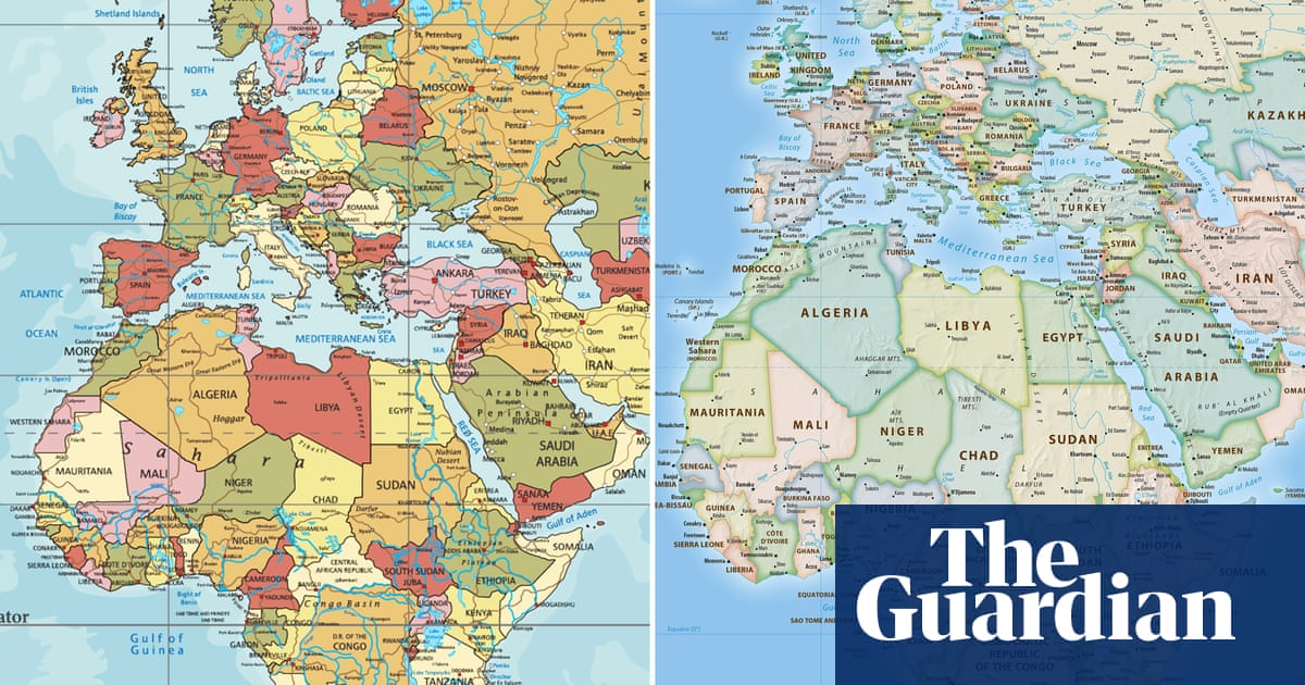
A momentous vote looms at the United Nations General Assembly, one that could fundamentally alter how the world views itself and, more specifically, the continent of Africa. On Friday, the global body will consider a resolution, spearheaded by Togo and passionately backed by all 54 member states of the African Union, to phase out the universally recognised but geographically flawed Mercator map. This proposed shift aims to replace the traditional projection with one that accurately depicts Africa’s true scale, challenging centuries of ingrained visual distortion.
For generations, the classroom walls, textbooks, and digital screens of the world have predominantly featured the map created by Flemish cartographer Gerardus Mercator in 1569. It was an ingenious solution for its time, designed to aid transoceanic navigation by preserving angles and shapes, thereby making sailing routes appear as straight lines. However, this mathematical convenience came at a significant cost: gross spatial distortion. Regions far from the equator, such as Greenland, Canada, and Russia, are visually inflated, while landmasses near the equator, like Africa and South America, appear drastically shrunken. The visual disparity is stark: the Mercator map suggests Africa is roughly the size of Greenland, yet in reality, Africa is a colossal 14 times larger than the icy Danish territory. This profound misrepresentation, as Togolese Foreign Affairs Minister Robert Dussey articulates, is not a political debate but a scientific one, demanding a collective acceptance of geographical reality.
Unpacking the Distortion: The Quest for Africa’s True Scale
The lingering dominance of the Mercator projection has extended beyond mere cartographic inaccuracy; it has subtly, yet profoundly, influenced global perceptions and power dynamics. Historians and geographers have long decried its Eurocentric bias, a phenomenon some activists have aptly termed “cartographic colonialism.” This isn’t just an academic debate; the visual shrinking of the Global South and the visual aggrandizement of Northern Hemisphere nations can, many argue, reinforce systemic biases across international trade, development policies, and even educational frameworks. It paints a picture of a world where certain regions are inherently more vast or significant than others, simply by virtue of their distorted graphical representation.
Consider the staggering reality: one could effortlessly fit the United States, China, India, Japan, Mexico, and substantial portions of Europe into Africa, with room still to spare. This eye-opening fact underscores the sheer magnitude of the distortion embedded in the traditional map. The #CorrectTheMap campaign, gaining traction with over 11,000 signatures on an online petition, seeks to rectify this longstanding misconception. Endorsed by the African Union, the campaign champions the adoption of more accurate projections.
This isn’t the first time an alternative has been proposed. The German historian Arno Peters introduced the Gall–Peters projection in 1973, offering an equal-area map that became a notable alternative to Mercator. However, it too had its own visual quirks. The current campaign is focused on promoting the 2018 Equal Earth design, developed by an international consortium of cartographers. This specific projection aims for a balance, depicting continents and countries in their proportional sizes while maintaining a more pleasing aesthetic than some earlier equal-area maps. Supporters believe embracing this design will be instrumental in reversing dated perceptions of Africa and, crucially, decolonizing global curriculums.
The Geopolitical Ripple Effect of a New Map
The potential adoption of a map that better illustrates Africa’s true scale carries significant geopolitical weight. JJ Enoch, a senior associate at the geopolitical risk advisory firm JS Held, observes that the Mercator projection visually diminished Africa’s real size, impacting its perceived standing. He links the #CorrectTheMap initiative directly to African nations’ legitimate aspirations for greater influence in global institutions and more control over their own representation on the world stage. An accurate, equal-area map, Enoch suggests, would furnish a more truthful foundation for education and public understanding, signaling unequivocally that Africa’s demographic, economic, and geopolitical importance demands a shift away from inherited, distorted conventions. Such a re-evaluation aligns with a broader global discourse on equity and representation, as nations grapple with complex issues like UN warnings about climate impacts and the pursuit of sustainable development goals.
While United Nations resolutions are not legally binding in the same way international treaties are, their symbolic power and persuasive influence cannot be overstated. A successful vote could trigger a cascade of changes, influencing everything from national educational syllabi to the digital mapping tools we use daily. Imagine a world where Google Maps, Apple Maps, and other ubiquitous navigation platforms automatically default to an Equal Earth-style projection. The shift in visual language would be profound, gradually reshaping how billions perceive the world.
Togolese authorities are optimistic, drawing confidence from a previous African Union-backed resolution earlier this year. In March, a Ghana-sponsored resolution declaring the slave trade as the “gravest crime against humanity” passed with overwhelming support from 123 states. This precedent offers a tangible hope that the resolution concerning Africa’s true scale will also find broad international consensus. Looking ahead, Togo’s government is already planning an implementation event in Lomé, its capital, next year. This gathering will involve UNESCO, the African Union, and major tech brands to strategize the practical rollout of the resolution. As Minister Dussey powerfully asserts, “To those who say why now, I say, why not? When we look at the world map… it is time for us to change the narrative.” It is, he contends, time for Africa to lead the charge in reshaping how it is seen, and how it sees itself, in the global tapestry.