
Environment Canada says Atlantic Canadians could be in for a wet long weekend
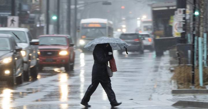
As a highly anticipated long weekend approaches, vast swathes of Atlantic Canada are bracing themselves for a relentless onslaught of precipitation. Environment Canada has issued stern warnings regarding a potent, slow-moving tropical system poised to drench the region, promising not just a damp holiday but also significant risks of localized flooding. This deluge of Atlantic Canada rainfall could very well redefine weekend plans for countless residents, urging vigilance and preparedness.
Forecasters from Environment Canada have pinpointed central and eastern Nova Scotia, along with the entirety of Prince Edward Island, as areas under explicit rainfall warnings. The projections are stark: some locations could witness an astonishing 120 millimetres of rain between tonight and Monday. Furthermore, the intensity of this downpour is not to be underestimated, with certain areas potentially experiencing rainfall rates of 10 millimetres per hour – a torrent capable of overwhelming drainage systems and rapidly transforming landscapes.
Understanding the Threat: Prolonged Atlantic Canada Rainfall
The core of this impending weather event lies in its nature as a slow-moving tropical system. Unlike swift-moving cold fronts, these systems tend to linger, methodically drawing moisture from warmer waters and unleashing it over extended periods. This characteristic significantly amplifies the risk of severe cumulative rainfall totals, creating a dangerous scenario for flash floods. The potential for embedded thunderstorms within this system only compounds the threat, promising localized bursts of even heavier precipitation that can exacerbate pooling on roadways and saturate already vulnerable low-lying areas.
Beyond the Maritimes, special weather statements have also been enacted for southeastern New Brunswick and Newfoundland’s Avalon Peninsula. While the projected totals are slightly less severe than those for Nova Scotia and P.E.I., with 20 to 70 millimetres expected, residents in these areas are still advised to exercise caution. The ground, already softened by previous rains, will have little capacity to absorb this fresh influx, increasing the likelihood of runoff and surface water accumulation.
Localized Flooding: A Dire Concern for Communities
The primary and most immediate concern stemming from this anticipated Atlantic Canada rainfall is the heightened risk of localized flooding. Imagine streets transforming into temporary rivers, underpasses becoming treacherous traps, and basements quickly succumbing to the rising water table. Such scenarios are not merely hypothetical; they are very real dangers associated with rainfall of this magnitude. Communities, especially those with historical flood plain vulnerabilities or aging infrastructure, must be particularly vigilant. The devastation wrought by severe flooding can be profound, impacting homes, businesses, and critical infrastructure, as seen in other global incidents. For instance, recent reports out of Nepal highlighted a glacier collapse and catastrophic flash floods that claimed hundreds of lives, a sobering reminder of nature’s formidable power.
Emergency services and municipal authorities across the affected provinces are undoubtedly preparing for potential interventions. Road closures due to standing water or washouts are a strong possibility, complicating travel and potentially isolating some communities. Power outages, a common companion to severe weather, could also leave thousands in the dark, further disrupting essential services and communication.
Preparation is Paramount: Protecting Property and Life
For residents in the affected zones, preparedness is not merely a suggestion; it is an imperative. Clearing eaves troughs and storm drains of debris is a simple yet crucial first step in mitigating immediate property damage. Securing outdoor furniture and other loose items will prevent them from becoming dangerous projectiles in high winds or being swept away by floodwaters. Furthermore, assembling an emergency kit containing essential supplies, such as non-perishable food, water, flashlights, batteries, and a first-aid kit, is always prudent during severe weather advisories. It’s also wise to ensure mobile devices are fully charged and to have alternative communication methods available.
Driving conditions are expected to deteriorate rapidly once the rains begin. Reduced visibility, coupled with the potential for hydroplaning on water-logged roads, means unnecessary travel should be avoided. If driving is essential, extreme caution is advised, and drivers should never attempt to navigate flooded roads, as the depth and current of the water can be deceptively dangerous. Just six inches of moving water can knock an adult off their feet, and a foot can sweep away a small vehicle.
As the long weekend unfolds, the eyes of many will be fixed on the skies and the latest updates from meteorological agencies. The incoming Atlantic Canada rainfall event serves as a powerful reminder of the unpredictable and sometimes harsh realities of nature, underscoring the critical importance of staying informed and prioritizing safety. Residents are strongly urged to monitor official weather warnings diligently and consult resources like a comprehensive flood preparedness guide to ensure they are equipped to face whatever the tropical system brings.